New to Orienteering?
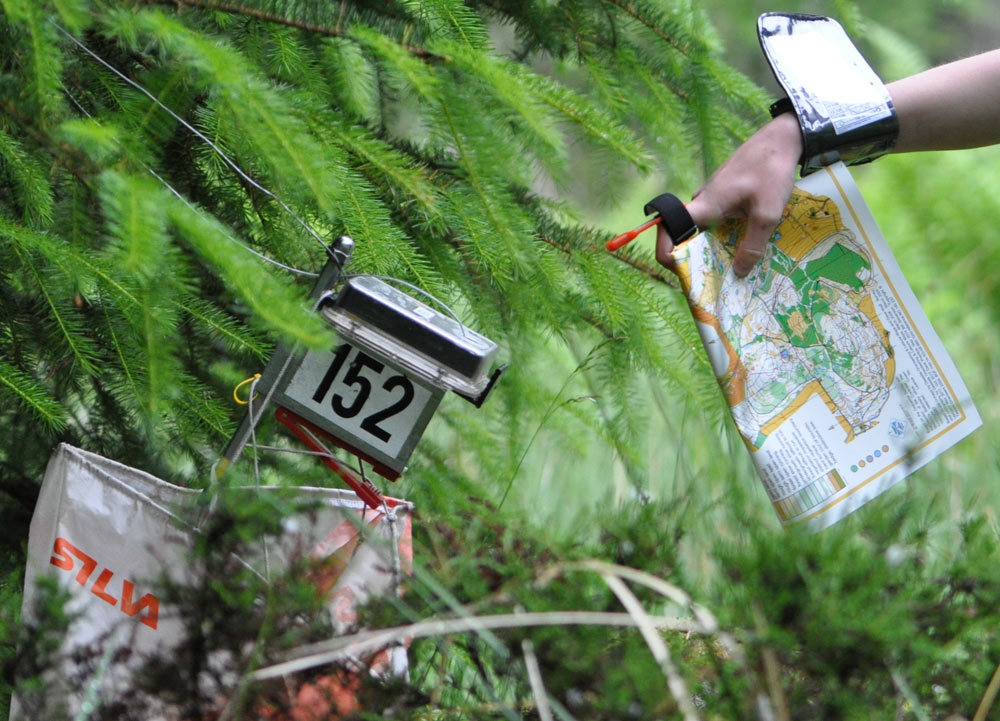
Visiting A Control Marker
Where can I orienteer? ”The best event for a newcomer is one of our typical Saturday Series events with details on this page.”
If you haven't tried orienteering before or are not very experienced the following links will help you get started.
- What is orienteering?
- What equipment do I need?
- What do orienteering maps and courses look like?
- When/where can I try it?
- A Family sport opens new experiences for all
- Permanent Orienteering courses
- Frequent Questions
- Safeguarding
- Video overviews of What is orienteering a beginners view, and a view the more elite adventure orienteering
For any more details, please feel free to drop us an email or come along to our next local event
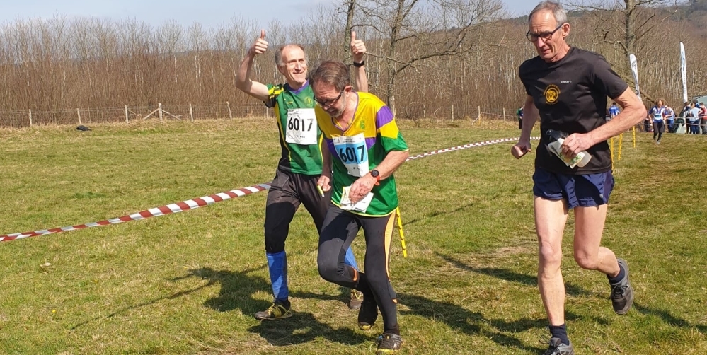
Running as a winning team
Orienteering is a sport that combines map reading and running. Competitors have to find their way between a series of checkpoints, called controls, as quickly as possible. There’s no set route between the controls, so you have to decide which way to go and then find your way there without getting lost.
You take part individually, and you don’t get to see the map with the course on it until the race starts, so you can’t plan your route or check out where the controls are in advance. The fastest person to visit all the controls in the right order is the winner.
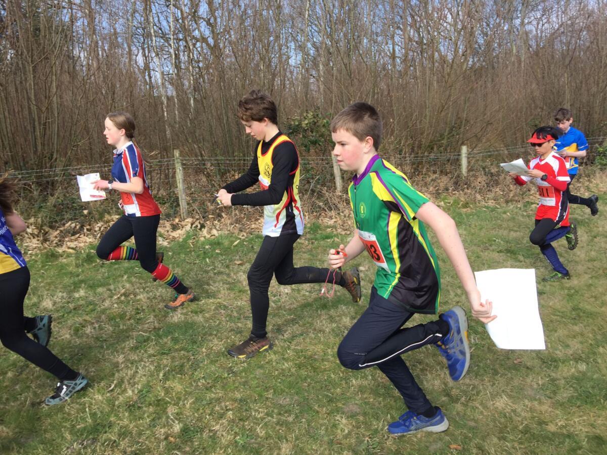
Opportunities are available to all, from the family that wish to walk around together to the elite orienteers that want to push themselves to the limit and beyond. Typically courses cover age groups from 10 to over 85, following a similar paradigm to the martial arts coloured belt system, i.e. white to black courses increasing technical and physical difficulty.
Don’t you get lost all the time?
Everyone gets lost sometimes, but you work out where you are sooner or later! It can be disheartening, but as you become more experienced and your navigational skills increase, you'll spend less time making mistakes.
It’s very unusual for the top competitors to get lost for any significant length of time, and when every second can make the difference between winning a medal and not, they generally consider even a few seconds’ hesitation to be time wasted.
Do you have to be able to run for hours?
Courses come in a variety of lengths, and as with navigational difficulty, most races offer a range of different course lengths, so there should be something suitable for all levels of fitness. The winner’s time for the hardest and longest course can vary between 15 minutes and almost two hours, depending on the type of race.
The top competitors will often be national standard road or cross-country runners, but the mental component is just as important and they also need fantastic navigational skills in order to win medals.
Doesn’t everyone just follow each other?
All the runners on the same course will start a minute or two apart to prevent everyone from following the person in front. Sometimes people catch each other up, but it’s never a good idea to blindly follow someone in case they make a mistake or they’re not looking for the same control as you.
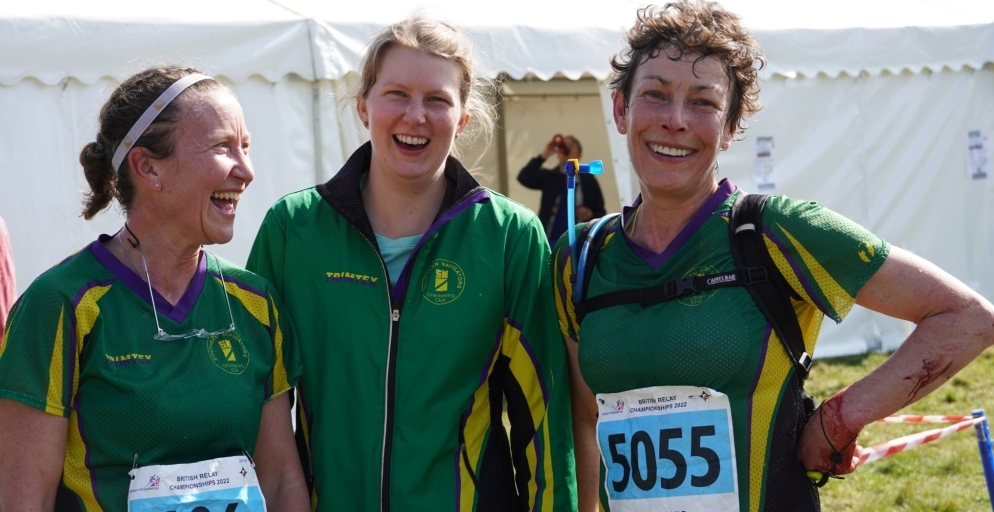
Ladies team at British Championships 2022
How do you know when you’ve got to the right place?
Each control is marked by a small orange and white marker, and has a unique code you can check to make sure you’ve found the right one.
Can’t you just cheat and say you’ve been to all the controls?
Everyone carries an electronic chip that they register at each control to prove they’ve been there. When you finish, you get a printout of how long you took between each control, meaning you can compare with other people and see where you lost time.
Orienteering maps and courses
Orienteering maps are very different to Ordnance Survey maps. They are very detailed and large scale and show footpaths, fences, streams and many other small features such as small depressions in the land surface. Importantly, they also show the type of landscape around you, such as fields and woodland, and even how thick the woodland is; this is indicated by the colouring on the map. Using this information you can then decide whether you can run through the woods or if the vegetation is so thick that they are best avoided.
This is a great link for giving you an idea of what the symbols mean, see Orienteering Map Legend
Most maps will have a "legend" on the side of the map explaining what each of the symbols mean, so very quickly most beginners come to terms with the colours and symbols. Map scales are typically 1:10,000 meaning 1 cm on the map is equivalent to 100m on the ground with contours depicting 5metres height differences.

Sample of an orienteering map
BRC2022
Where do you do it?
Anywhere! Big races in the UK in the past year have taken place in locations ranging from the streets of Central London and Edinburgh to remote mountainsides in the Scottish Highlands and the Lake District. Races take place across the country every weekend, with common venues including forests, moorland, town centres, parks, and university campuses.
We also have a selection of Permanent Orienteering Courses, which you can use anytime.
However a great starting point is our events page, that not only lists events hosted by Southern Navigators but also some of our neighboring club events are linked. The best events for a newcomer our typical one of our Saturday series events with details on the events pages.
Do you need loads of expensive kit?
You’ll need running clothes and trainers, including long running trousers if the race is in the countryside. A compass is very useful, particularly on the more difficult courses, but you’re not allowed to use a GPS or the map on your phone to help you! Some races might require you to carry a whistle for safety. You can cheaply hire the electronic timing chips at each race, and your entry fee will include your own copy of the race map.
How do I know how hard the courses are?
Most events offer a range of courses with varying degrees of navigational difficulty, so there’s something to suit all ages and levels of experience. The easier courses stick to paths, while the harder ones require more complex navigation and advanced map reading skills. How the courses are graded will vary from event to event, so it's best to ask one of the club volunteers, who'll be happy to recommend a course for you to try.
Sounds great! How can I give it a go?
The club has events at weekends and weekday evenings. We also offer coaching sessions for newcomers.
Useful links
Visit our Orienteering Links page for lots of useful links.
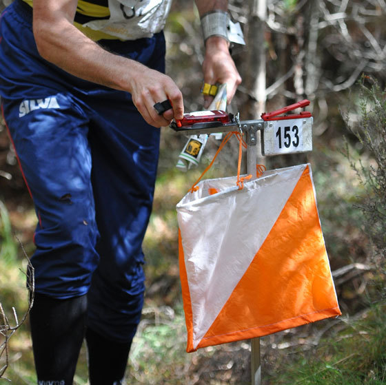
Orienteering Control